Seeley Creek Nordic Ski Trails
Seeley Lake's temperature is in the 60's today and we've been experiencing a major melt out, just in time for Spring.
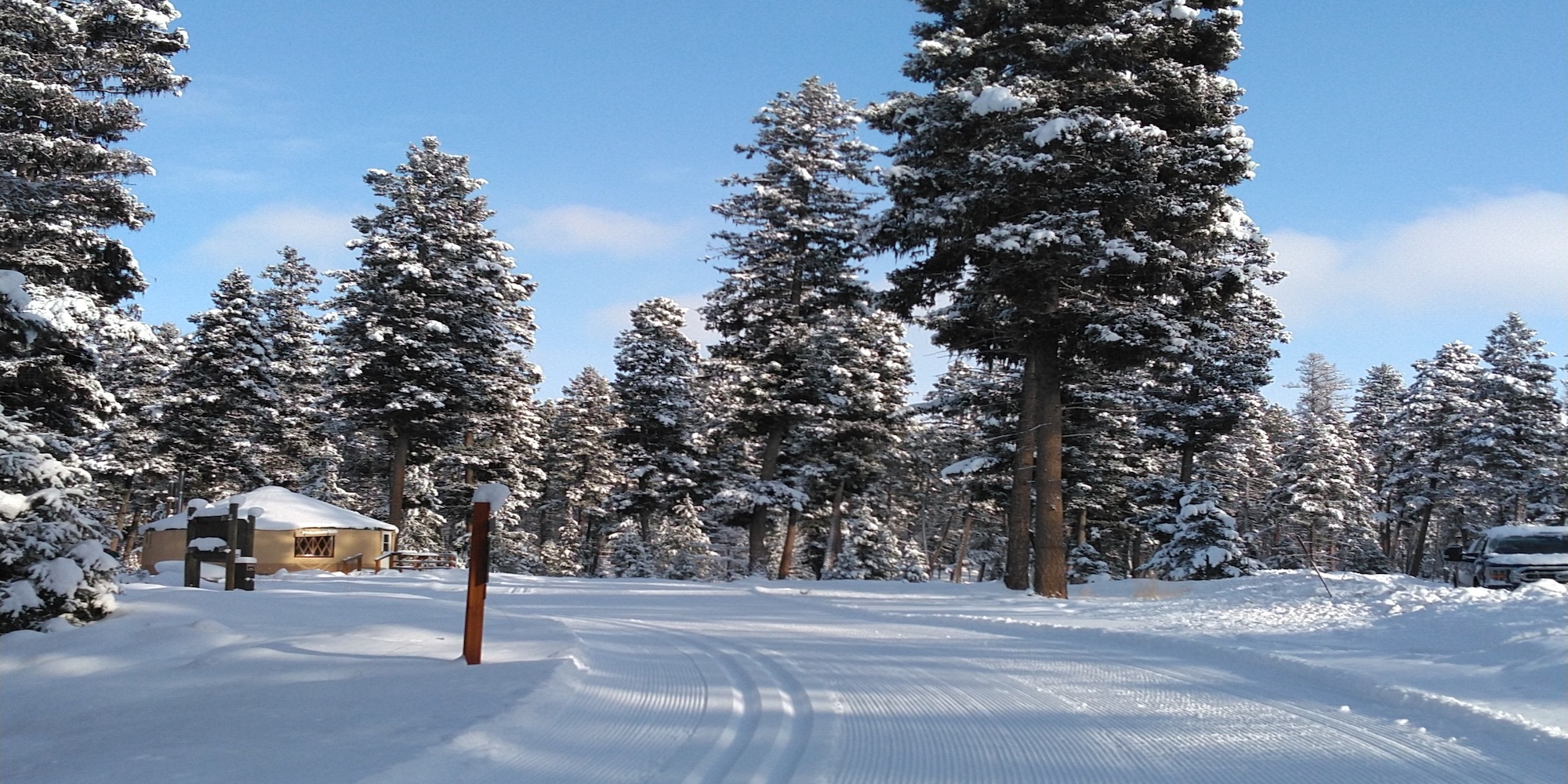
Our season is most likely over, but we were lucky to experience one final weekend with the best coverage of the season.
We have begun base preparation for the 2025-2026 season! Stay tuned...
During the grooming season (December 1 thru March 31) the ski trails are intended for skiers only in order to reduce damage to the groomed surface and to minimize conflicts with other users. Please see the SLNSC website for suggestions for other winter recreationists.
Please review the notes associated with the trails you plan to ski; note that referenced junction numbers are physically posted at each junction marker on the trail system and also shown on our website trail map. Skiing against the intended direction of travel, as designated in the notes associated with each trail, may result in accidents and injuries.
The Seeley Creek trail system received a substantial amount of storm damage on Wednesday, December 17, in the form of downed trees. Well over 150 trees were down across various segments of the trail system.
UPDATE: Most of the trees have been cleared from the Main trail system and Area X. At this time, only Roller Coaster still needs to be cleared.
During the grooming season (December 1 thru March 31) the ski trails are intended for skiers only in order to reduce damage to the groomed surface and to minimize conflicts with other users. Please see the SLNSC website for suggestions for other winter recreationists.
Please review the notes associated with the trails you plan to ski; note that referenced junction numbers are physically posted at each junction marker on the trail system and also shown on our website trail map. Skiing against the intended direction of travel, as designated in the notes associated with each trail, may result in accidents and injuries.
Area X +
| ABC | Distance | Open | Last Groomed | |
|---|---|---|---|---|
Area X Entry | 0.06km | |||
Area X Exit | 0.06km | |||
Blue 1 | 0.5km | |||
Blue 1/Blue 3 Connector | 0.03km | |||
Blue 2 | 0.21km | |||
Blue 2/Blue 3 Connector | 0.02km | |||
Blue 3 | 0.39km | |||
Green 1 | 0.37km | |||
Green 1/Green 2 Connector | 0.01km | |||
Green 1/Green 3 Connector 1 | 0.01km | |||
Green 1/Green 3 Connector 2 | 0.02km | |||
Green 2 | 0.25km | |||
Green 2/Green 3 Connector 1 | 0.04km | |||
Green 2/Green 3 Connector 2 | 0.02km | |||
Green 3 | 0.39km | |||
Green 3 Connector | 0.03km | |||
Logging Camp/Area X Connector | 0.29km | |||
Teaching Area Crossover | 0.06km | |||
Teaching Area Entrance | 0.03km |
Main Trail System +
| ABC | Distance | Open | Last Groomed | |
|---|---|---|---|---|
1 KM Loop Cutoff | 0.05km | |||
10 KM Loop | 9.91km | |||
3 KM Loop | 2.98km | |||
5 KM Loop | 4.98km | |||
5 KM Loop Connector | 0.33km | |||
5 KM Loop Cutoff | 0.36km | |||
7 KM Loop | 7.01km | |||
Bear Tree | 1.81km | |||
Biathlon Range Cutoff | 0.08km | |||
Biathlon Range Entry/Exit | 0.2km | |||
Bull Pine | 0.81km | |||
Hawk Woods | 1.71km | |||
Larch Knob | 1.83km | |||
Larch Knob Bypass | 0.79km | |||
Larch Knob/Hawk Woods Connector | 0.06km | |||
Logging Camp Loop | 1.75km | |||
Moose Meadows | 2.19km | |||
Moose Meadows/Hawk Woods Connector | 0.1km | |||
Mountain View | 1.49km | |||
Roller Coaster - Lower | 1.43km | |||
Roller Coaster - Upper | 1.14km | |||
Roller Cutoff | 0.54km | |||
Spruce Alley - The Adventure Trail | 0.45km | |||
Two Creeks | 2.7km | |||
Whitetail Run | 0.81km |
Addition +
| ABC | Distance | Open | Last Groomed | |
|---|---|---|---|---|
Auggie East Gate Connector | 0.17km | |||
Auggie Road | 3.99km | |||
Auggie West Gate Connector | 0.13km | |||
Skyline Addition | 3.94km |